To reach a very high resolution of 50m horizontally, Aventage relies on two distinct and successive downscaling processes to produce its results.
1 An operational processing chain from large-scale weather forecasts (GFS 50km) up to 1km resolution.
Each day, the SportRIZER & RiskWeatherTech operational chain downloads the 0h00 GFS forecast data for the 0h00+1h to 0h00+48h time frames and performs a downscaling simulation with
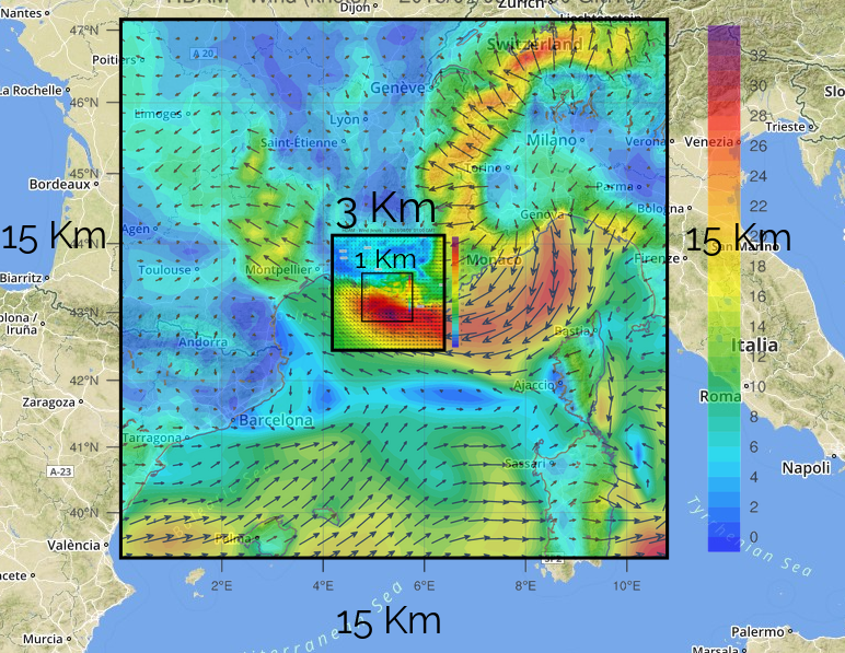
WRF domain configuration (courtesy of SportRIZER & RiskWeatherTech)
the WRF model down to 1km resolution over the Marseilles area. These hourly forecast data for the same day (for the 0h00+1h to 0h00+48h time frames) are available around 6h00 in the morning. Downscaling to 1km resolution is performed with the Weather Research and Forecasting (WRF) model developed at the National Center for Atmospheric Research (NCAR), on a 60kmx60km area, centered on Marseilles.
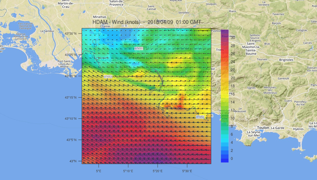
The nested 60kmx60km WRF area, centered on Marseilles with 1km resolution (courtesy of SportRIZER & RiskWeatherTech)
The downscaling is done by successive nesting of 3 domains whose resolution is improved between each domain (15km, 3km and 1km) as shown.This operational chain results in the output of a wind data of 1km horizontal resolution on 60kmx60km over the entire troposphere (about 20km) with 45 vertical levels distributed non-linearly.
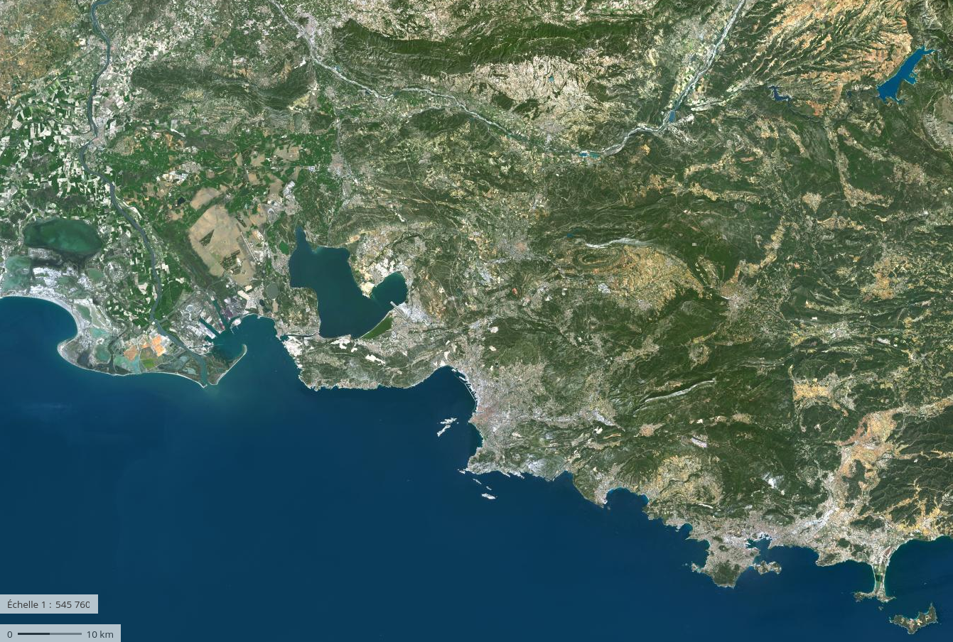
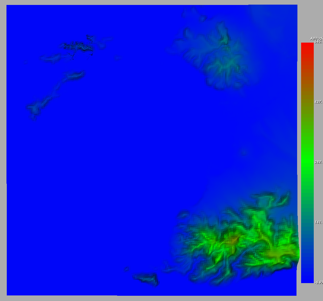
Aerial view around the 60km WRF domain
For the following WindPoS chain, more frequent outputs in time (every 10 minutes) are produced over a 24-hour period.
2 A specific downscaling from the previous operation.
To refine the wind simulation, starting at 1km resolution, Aventage relies on the SDM-WindPoS model.
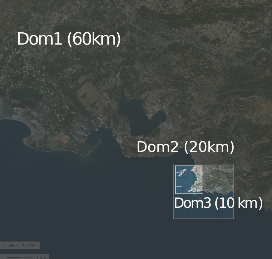
The two nested SDM downscaling domains
The target domain of size 10kmx10km is defined centered on the water body. This size on 10km corresponds to a reduction factor of 1/6 in the horizontal, similar to the first WRF downscaling ratio of 15km to 3 km.
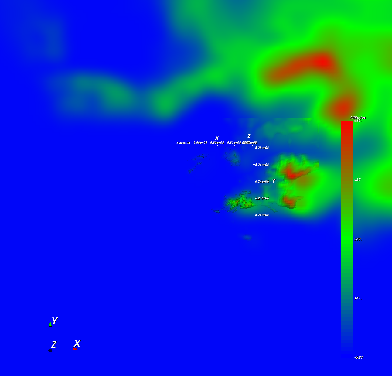
The targeted domain of size 10km corresponding to the water body area, nested at the center of the 60kmx60km WRF 1km domain. The WRF embedded topography is refined at the center with the alignment of a 5m elevation data.
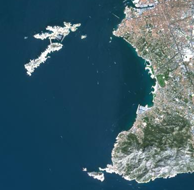
Aerial view of the 10km nested domain.
Embedded topography in SDM-WindPoS for the 10km nested domain.
A 20kmx20km intermediate size domain is also introduced, aligning with the 1/3 ratio of the last WRF downscaling, and with a1/2 ratio to arrive at the 10km target domain on which two spatial resolutions (150m and 50m) are tested.